Call Us Anytime (801) 725-8395
Request a Survey
ULS Logo
×

ULS Land Surveying provides precision boundary, topographic, ALTA, and construction staking services.

(801) 725-8395

[email protected]

Accurate. Compliant. Development-Ready.

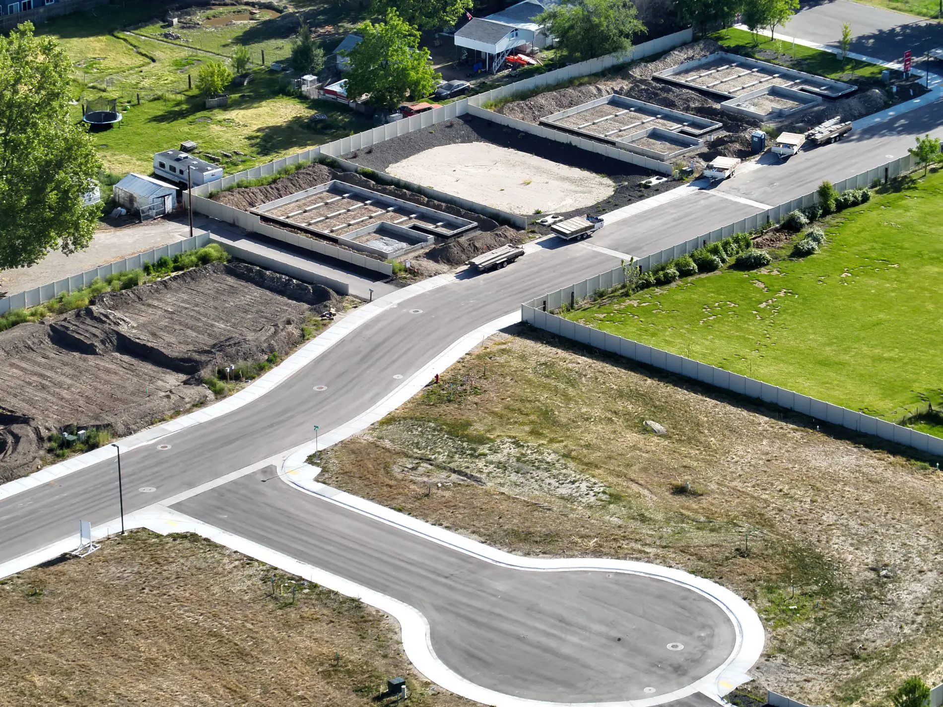
ULS delivers precise land surveying solutions across Northern Utah, supporting residential, commercial, and municipal development.

  • Boundary & ALTA Surveys
  • Subdivision & Annexation Plats
  • FAA Certified Drone Mapping
  • Development Coordination Support
Additional Details
Surveys Plats Development Our Success
3

State Certifications

2

Government Affiliations

99k+

Square Miles Surveyed

Survey Services
FIELD SURVEYING

Professional Survey Services

Legally defensible and precision-driven surveys supporting residential, commercial, and municipal development projects.

  • State licensed professionals
  • FAA Part 107 drone certified
  • Advanced GPS & robotic equipment
  • Clear documentation & mapping

ALTA Surveys

Commercial-grade title surveys meeting national standards.

  • Table A options
  • Lender compliance
  • Easement mapping

Boundary Surveys

Accurate property line determination & verification.

  • Encroachment review
  • Legal descriptions
  • Ownership clarity

Topographic Surveys

Detailed elevation & terrain modeling for engineering.

  • Contour mapping
  • Drainage analysis
  • Utility documentation

Aerial Surveys

Drone-based orthomosaic imaging & 3D modeling.

  • High-resolution imaging
  • Large parcel mapping
  • Construction monitoring

Need Accurate Field Data?

Schedule a consultation to discuss your survey requirements.

Request Survey Service
LAND DIVISION & RECORDING

Professional Plat Services

Strategic plat preparation and land division services aligned with municipal requirements, state statutes, and long-term development goals.

  • Municipal coordination & approvals
  • Recorded legal documentation
  • Boundary & title integration
  • Development-ready compliance
Plat Services

Annexation Plats

Incorporating property into municipal boundaries with coordinated city approvals and statutory compliance.

  • Municipal boundary adjustments
  • Public notice compliance
  • Legal description revisions
  • City council coordination

Consolidation Plats

Combining multiple parcels into a single legally recognized lot with proper recording documentation.

  • Parcel merger preparation
  • Title coordination
  • Updated legal descriptions
  • County recording

Vacating Plats

Formal removal or modification of previously recorded plats, easements, or rights-of-way.

  • Easement termination
  • Right-of-way adjustments
  • Municipal hearings
  • Recorded amendments

Subdivision Plats

Comprehensive subdivision mapping supporting residential and commercial development projects.

  • Lot layout & design
  • Utility dedication mapping
  • Planning commission approvals
  • Final plat recording

Planning a Land Division Project?

Let’s coordinate your plat preparation with local authorities and ensure a smooth approval process.

Start Your Plat Project
Development Services
LAND PLANNING & EXECUTION

Development Support Services

Integrated land development services supporting engineering, construction, and municipal compliance from concept through project completion.

  • Engineering coordination
  • Municipal compliance alignment
  • Precision field implementation
  • Development lifecycle support

Construction Staking

Precise layout services ensuring structures are built according to engineered design plans.

  • Foundation layout
  • Utility placement staking
  • Grade & elevation control
  • On-site verification

Site Plans

Comprehensive site planning documentation prepared for municipal review and development approval.

  • Property layout design
  • Access & circulation planning
  • Utility coordination
  • Submission-ready drawings

3D Scanning

High-resolution 3D data capture supporting engineering, renovation, and infrastructure projects.

  • LiDAR data collection
  • Point cloud modeling
  • Existing condition mapping
  • As-built documentation


Civil Engineering Support

Coordinated surveying data and mapping aligned with civil engineering design requirements.

  • Grading plan integration
  • Drainage analysis support
  • Infrastructure layout
  • Design coordination

Aerial Mapping

Drone-based orthomosaic and 3D mapping for large-scale development sites.

  • Orthophoto generation
  • Terrain modeling
  • Progress monitoring
  • Volume calculations

Zoning & Land Use

Strategic navigation of zoning codes and land use regulations to streamline project approvals.

  • Zoning analysis
  • Land use compatibility review
  • Municipal coordination
  • Development feasibility insight

Ready to Move Your Project Forward?

Let’s align surveying, engineering, and municipal requirements to bring your development from concept to completion.

Schedule Development Consultation

The Pillars of Our Success

Advanced Technology

Modern GPS & robotic total stations.

  • RTK precision
  • Drone mapping
  • 3D terrain modeling
Regulatory Expertise

Deep land use compliance knowledge.

  • Municipal coordination
  • Zoning analysis
  • Code adherence

Development Experience

Proven leadership in subdivision, annexation, and large-scale development support.

  • Subdivision plats
  • Annexation strategy
  • Developer coordination
  • Entitlement support
Licensed & Certified

Multi-state licensure & FAA Part 107.

  • State certified
  • Fully insured
  • Industry compliant
On-Time Delivery

Dependable documentation turnaround.

  • Clear timelines
  • Efficient fieldwork
  • Consistent updates
GET FREE QUOTE

Have a project in mind?

Are you a New or Existing Customer?